
Protect Your Yield.
Maximize Every Acre.
Meyer AgTech delivers same-day crop intelligence through fully autonomous aerial systems—detecting stress, disease, and nutrient gaps before they cost you.
What We Do
Our mission is to empower both agronomists and growers with real-time, field-ready intelligence—so decisions are faster, more precise, and more profitable.
Detect early-stage stress, disease, and nutrient issues across the entire field—before they become visible
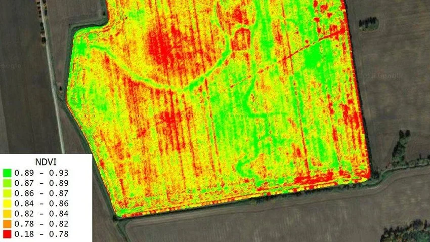
Generate NDVI, NDRE, and other vegetation indices to support expert analysis and recommendations
Provide prescription-ready zone maps for targeted applications, scouting, or in-season management
Close the loop with DJI Agras drone integration—allowing autonomous variable-rate treatments of only the affected zones
Save time, reduce input waste, and protect yield—all from one autonomous flight
How We Do It
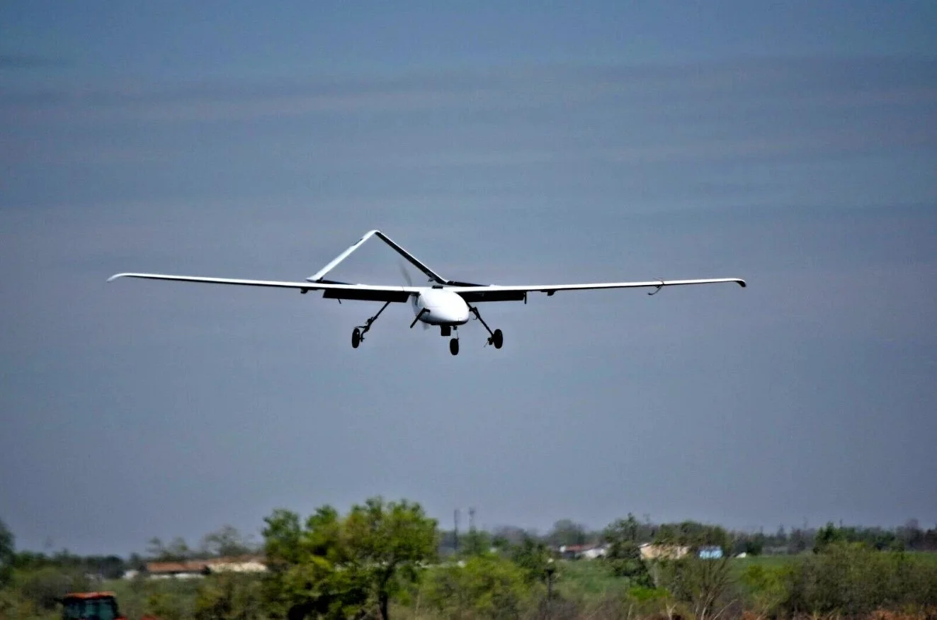
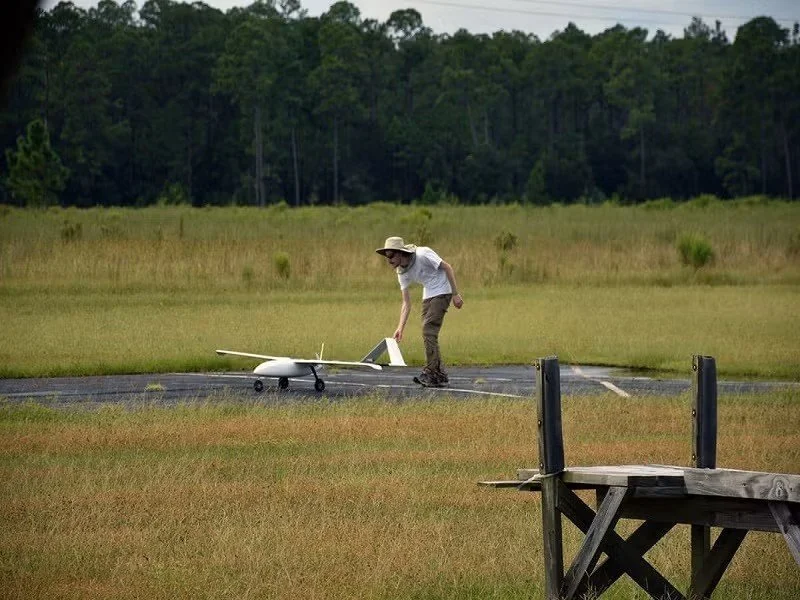
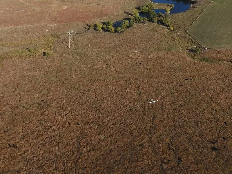
Launch a fully autonomous fixed-wing aircraft capable of scanning over 3,000 acres per flight
Capture high-resolution multispectral imagery across five spectral bands (Blue, Green, Red, Red Edge, NIR) to detect physiological changes in crops
Use onboard AI processing to identify early indicators of stress, nutrient deficiency, pest pressure, and disease—before symptoms appear visually
Analyze imagery to generate NDVI, NDRE, and other vegetation indices that support agronomic diagnosis and decision-making
Convert field data into georeferenced prescription zone maps, allowing for variable-rate input strategies and efficient scouting
Seamlessly integrate with DJI Agras drones by exporting task files for autonomous variable-rate applications, targeting only affected zones
Deliver all results—including maps, indices, and task files—within 3 hours of flight, enabling same-day treatment and rapid response
Leverage a proprietary onboard AI system that processes and interprets data in-flight—a capability not offered by any major drone provider today
Our Services
Meyer AgTech is currently a pre-seed startup without a fully operational prototype—we’re actively raising funds and partnering with early adopters to build our working UAV+AI platform. In the meantime, we’re offering all three tiers (Scout Essentials, Insight & Prescribe, Integrated SpraySync) at special introductory rates to gather real-world feedback and refine our system. As a farmer-centric company, we guarantee transparent pricing with no hidden fees or overcharging—your support now helps us bring affordable, high-impact AgTech to market.
-
At just $1.50/acre, Scout Basic delivers high-resolution multispectral and RGB aerial scans with AI-driven crop intelligence to flag stress zones, nutrient gaps, and disease hotspots automatically. Your interactive prescription map arrives within 3 hours after the flight—and we can send the full report directly to your agronomist for seamless collaboration.
-
For $3/acre, you get everything in Scout Basic plus a 30-minute phone consult with our agronomist to walk through your field data, fine-tune application strategies, and answer your questions.
-
At $8/acre, Integrated SpraySync loads your AI-driven prescription map into fully autonomous DJI Agras or Hyli.io spray drones, which use onboard cameras and AI to verify precise droplet distribution in real time. Within three hours of mission completion, you’ll receive a detailed coverage report—with any flagged zones and the option to CC your agronomist—so you can trust every acre is treated correctly.
Book a Demo Flight
Free 15-Minute Consultation
Let’s start with a quick, no-obligation chat where we’ll learn about your farm, acreage, and pain points. This call helps us tailor the perfect demo and ensures you’re ready to see the platform in action.
100-Acre Complimentary Flight
We’ll fly your first 100 acres at no cost—using our drones’ multispectral and high-res cameras to uncover hidden stress, disease, and nutrient gaps before they cut into your yield. Within three hours of landing, you’ll get an easy-to-read, color-coded map showing exactly where to focus your next pass—backed by a quick call from our team to walk you through every insight.
Built From the Ground Up
Meyer AgTech started with one goal: to give farmers more good years than bad. Growing up, I saw the reality of farming—the seasons that went well, and the ones that didn’t. That experience stuck with me.
With a background in military aviation maintenance and as a senior studying mathematics and computer science at the University of Nebraska–Lincoln, I founded Meyer AgTech to build tools that will truly do good in the field.
We're developing intelligent, fully autonomous aircraft capable of scanning thousands of acres, identifying crop stress with AI, and delivering actionable insights—within 3 hours or less of landing. These aircraft don’t just fly—they think, analyze, and adapt.
This isn’t just about tech. It’s about building something growers can trust to get the job done right so that there are more good years in the future.

Let’s Connect
Whether you're a grower, agronomist, or just curious about what we’re building, we’d love to hear from you. Fill out the form and we’ll be in touch shortly with next steps.